
St. Louis Weather Forecast: Warming Trend Precedes Weekend Cooling
St. Louis can expect a warming trend into the 80s through Thursday, followed by widespread rain and storms late Thursday into Friday, before cooler temperatures return for the weekend.

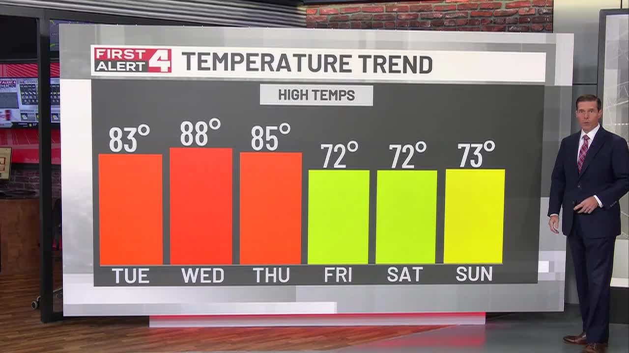
 St. Louis, MO, September 28, 2026 — The St. Louis metropolitan area is set to experience a significant warming trend this week, with temperatures expected to climb into the 80s. This period of warmth is anticipated to continue through Thursday.
Following the warm spell, residents should prepare for a change in weather patterns. Widespread rain and storms are forecast to move into the region starting late Thursday and continuing through Friday.
As the weekend approaches, a shift back to cooler temperatures is predicted. Details regarding the specific temperature ranges for the upcoming weekend were not immediately available.
The timing of the transition from the warming trend to the stormy conditions, and subsequently to cooler weather, is a key aspect of the forecast. While temperatures are expected to reach the 80s, the precise highest temperature is not specified. Similarly, the intensity and duration of the storms late Thursday and Friday will be closely monitored.
The forecast indicates a dynamic weather system impacting St. Louis, moving from unseasonseasonably warm conditions to unsettled weather, and then returning to a cooler pattern for the weekend. Meteorologists are tracking the development of the low-pressure system expected to bring the rain and storms. The cooling trend anticipated for the weekend is a common autumnal shift, but the exact degree of the temperature drop will become clearer as Friday progresses and more data becomes available.
Residents are advised to stay informed about weather updates as the forecast develops, particularly concerning the timing and severity of the expected rainfall and thunderstorms. The exact temperatures and conditions for the weekend are still being refined by weather models. The week’s weather progression highlights the variability that can occur in the region’s climate this time of year, moving from summer-like warmth to autumn-like conditions within a short span. The official temperature high for the warmest days and the expected low temperatures for the weekend have not been provided.
Further details on precipitation amounts and potential storm impacts will be released as they become available. The public can expect the current warm conditions to dissipate by the end of the week, making way for a wetter and cooler period before settling into the weekend forecast.
Story summarized from the original created by Steve Templeton on www.firstalert4.com, see more information here.
Media gallery


